As anyone who has been watching my social media would notice, I recently did some travelling. Of course, I'm generally on the move a lot, but the trip I'm referring to now was an outlier in many ways. For example, I've rarely ever felt so mad excited (and afterwards, satisfied) about a trip that didn't even involve crossing a single international border - at least, not for me. While I've never minded domestic travelling, it has never been quite as special as going to another country; but of course, now that I live in Norway, a world-class tourist destination, I dare to say that rule can be rewritten. However, my mother, who was my travel companion this time around had to cross a couple of borders to get here; in fact, this trip was a surprise-present from me to her.
Throughout the whole planning and waiting stage that lasted for about two months, it felt like the most ridiculous idea ever. It was also somewhat tricky to find the perfect balance between all the ideas I had and constrictions of time, budget and eventually, energy. Thankfully, I managed to concoct a plan I was and still am extremely satisfied with, which ended up (not quite intentionally) having many similarities to a part of my first ever trip to Norway that Sverre organised for me. One of the similarities being that the two trips were just a day or two (depending on what part you look at) away from being exactly three years apart. Anyway, the blog post about the similar part of my first trip can be found here, should you fancy running a comparison. In any case, even if I had been through most of this before, it still proved to be quite a lot of new and exciting experiences for me, let alone for my mother to whom all of this was new.
26th of April, 2016. The weather was actually lovelier that day, but it had generally been colder that spring, which meant more snow in the mountains and mostly frozen waterfalls.
25th of April, 2019. The weather was mostly overcast, and I couldn't really retake the photo quite as far out on the pier as I had in 2016, because there was a small ship parked there all day and she would've covered up most of the background.
Now, those who have been reading my old blog(s) for years, know that I'd sometimes give some music to accompany my posts. Heck, this is probably going to be a bit of a read, so you may as well buckle up, and if you wish for something to enhance the mood, enjoy this.
For me, the trip started with a half early wakeup and a half hellish two hour bus journey to the airport. I was actually feeling surprisingly fresh, considering that I have struggled with motion sickness in the past, but for the first hour of the bus ride, the ticket machine was giving some extremely annoying beeping alarm, and our pleas to the bus driver weren't of much help as we found out he couldn't hear it at all. Thankfully, it did eventually stop somehow, and I could at least relax for the rest of the journey. After arriving to the airport, I found myself derping around there for another hour, since it had been quite difficult to assess how long it would take my mum from touching down to the arrivals gate, and I'd preferred to be early rather than late.
Anyway, after we'd finally met and exchanged some greetings, I asked my mother (as I hadn't told her anything at all about the plan) where she thought we would be going next. When she failed to give any good answer, I just said "upstairs!" and watched her go from extremely surprised to excited as I checked us in for our flight to Bergen.
The flight was absolutely lovely. The weather was lovely, it was very smooth, especially to be a flight over some considerable mountains, and the views from the window were absolutely gorgeous all the way until touchdown.
All of this is good to have and even better to not need.
Just after takeoff; three tiny lakes (no more than a couple hundred meters across) north of Oslo, from the left: Skjellbreia, Tjerntjernet, and Vestre Buvatn.
Storelva river running through Hønefoss
Over the vast Hardangervidda plateau.
Eidfjord village, between the lake and fjord that bear the same name. The fjord is the innermost branch of Hardangerfjord.
Hardangerfjord, with Hardanger bridge, the longest suspension bridge in Norway and the longest tunnel to tunnel suspension bridge in the world, going across. The bridge is 1380m long, with a main span of 1310 meters, and was opened in 2013.
Fyksesund, a small northward branch of the Hardangerfjord, surrounded by Kvam municipality and many small, nearly abandoned villages that lack road connections and can thus be reached by only foot or boat. At the end of the fjord is Botnen, one such village, that used to be the home of two well known makers of Hardanger fiddles, father and son, in the 17th-18th century.
Skulstadvatnet lake, with Sørfjorden on the background, and behind that, to the left, the Osterøy island, which is surrounded entirely by fjords and is the largest island in Norway that's not directly adjacent to the ocean.
Much more difficult to pinpoint the location from such a low height, moments before touchdown. So, this is somewhere just north of the Bergen airport in Flesland.
After touching down in Bergen and passing through the shiny recently rebuilt airport, we took the shiny new tramway to the city centre and checked in to our lovely hotel. It was then that it hit me how glad I was that I had booked us for two nights, since just one evening in Bergen would've been somewhat of a rude tease.
The end stop of the tram line, right next to Byparken, the central park in Bergen.
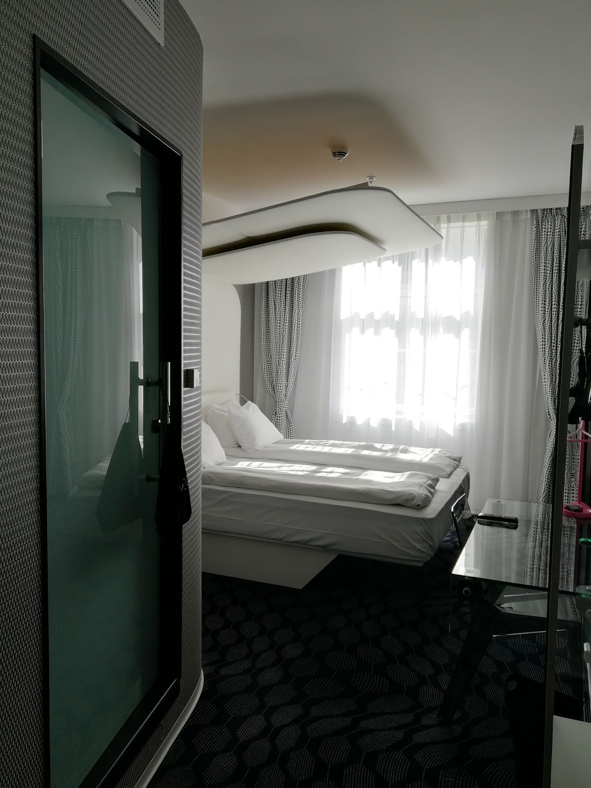
Our lovely room in Magic Hotel Kløverhuset. We were given a minor upgrade upon arrival, which was a nice touch.
After dropping off our luggage, we had no time to waste; we had safely arrived to one of the most beautiful cities, so it was time to head out to look around. Here, a nice view of a row of Hanseatic buildings, known as Bryggen, on the right, and the tall ship Statsraad Lehmkuhl on the left.
St Mary's Church, built between 1130 and 1180, which makes it the oldest remaining building in all of Bergen. The latest renovation was finished in 2015, thus the fresh look.
A sign pointing towards the small fortress which I chose as the best location to enjoy my dinner, a small cheeseburger.
After a little tour north of central Bergen, it was time to do the first mandatory tourist thing and take the funicular Fløibanen up to Fløyen, a viewpoint 320 meters above sea level.
View west from Fløyen...
... and southeast...
... and down, featuring one of the two Fløibanen funicular cars. The Fløibanen funicular service celebrated its 100th anniversary last year.
Photos taken at the viewpoint could almost seem to have been taken in front of a nice backdrop.
After looking around the top, we decided that there is plenty of time, so instead of taking the funicular back down, we took a winding forest road.
The winding forest road was quite popular on such a lovely day.
There was a bench with a nice view at almost every hairpin turn.
If you look very closely, you can see three levels of the winding forest road here.
It's always the most inviting shady pathway that's closed due to landslide risk.
A much needed resting point. The plaque behind the bench says "Husk at Hesten trenger Kvile", which translates to "Remember that the horse needs rest".
I really hope that the girl who was deeply immersed in her book doesn't mind being so rudely published; she certainly picked an excellent and very majestic location to read, and made an excellent addition to this photo.
Fjellveien, an intermediate station on the Fløibanen.
It was also around this point that the winding forest road was replaced by winding residential area road.
Another Fløibanen view, a couple of hairpin turns further down.
A few minutes later we came to a nice pond called Skansedammen, which couldn't have been a better find; our tired feet were really happy to be dipped in the cooling water. The pond was also quite popular that day, many were taking in the sun and some were even grilling. In winter, it serves as an ice skating rink. Some years ago, the pond and the area around it were entirely redone, which included the addition of a large car park underneath it, reducing the depth of the pond from several meters down to just 20cm, a move that made a lot of people very angry...
... but not me!
After a nice rest at Skansen, it was just to go down a few more flights of stairs, and we were back at the base...
... as seen here; the little white building that's cut off by the left edge of this photo, is the Fløibanen base station where we started our mountain trip of the day several hours earlier.
From there, we followed the most attractive-looking streets towards Byparken.
In addition to the landmark pond (which is quite a bit larger than the one up in Skansen), Byparken was full of beautiful pink blossoms.
... Speaking of the landmark pond - it's called Lille Lungegårdsvannet and it was originally a much larger lake, part of Puddefjord, connected to a larger bay further inland by a narrow strait, as can be seen in this old map. As the city grew around it, the lake was gradually shrunk until in 1926 it was given its current shape, the strait was filled and the water connection to the bay was driven underground.
The statue of Christian Michelsen may be very tall and very important, but this seagull is even more important.
The beautiful metallophone sounds played by one of the people on the benches added a whole extra layer to the magical atmosphere.
A fountain-statue of Ole Bull, a virtuoso violinist of the 19th century. Bergen has produced a very impressive number of extremely talented musicians; Edvard Grieg was also from Bergen, and some more recent examples would be Ylvis, Alan Walker and Kygo. A relatively little known personal favourite of mine, Philter, whose music I chose to start this post (and the next one too, as a minor spoiler), has also spent most of his life in Bergen.
After the walk in the centre, we decided to get back to the hotel early to get a proper sleep. After all, another full day to explore Bergen was still ahead. So, on day 2 we got up decently early and took a bus a little bit further into the city. I was very excited for this part myself, as I'd never been on top of Ulriken, the highest mountain in Bergen; it had only been right there in bare sight whenever I'd been around. Additionally, I was very keen to be taking the cable car, as I had never taken one before, despite having a few occasions where I had been really close to taking one.
However, as we approached the base cable car station, I noticed that it was eerily quiet, and then saw a sign that initially felt like a slap in the face.
"Closed due to wind."
While doing research for the trip, I had heard of such a possibility, but yet I had completely failed to actually consider it, somehow being absolutely certain that it won't be an issue. It didn't feel particularly windy that day, although it wasn't completely still either; we could feel the occasional gentle breeze. Strongly disappointed, I sat down for a while, cursing myself for not having done this the day before, considering possibilities and wondering whether the conditions would change and the cable car be reopened.
When I eventually concluded that it probably won't happen, I considered alternative activities, but failed to come up with anything. The idea to just go up there anyway had started to stew in my head. It took us another good while to strongly consider everything, but eventually, at exactly 11:16 as the timestamp on a photo later testified, driven by a considerable summit fever I had gotten, we went off without any idea of what lay ahead. We started by taking a narrow, somewhat steep and challenging forest trail right next to the station, which, in hindsight, wasn't quite necessary.
Challenging forest trail....
... and the pretty waterfall it lead us past.
Eventually, following the trail, we came out of the forest again and onto a much safer path and some signs with information. There, we took a short break to consider further, but my summit fever wasn't going to see us turn around until there was absolutely no way forward. So on we went.
Next up, it was a what felt like a while of relatively comfortable gravel paths, but as we progressed, they really got quite steep. It already felt like we had walked a couple of kilometers, and yet the summit was still far ahead and above, in this picture just neatly hidden by the tree slightly to the left from the middle.
Here's a picture of me taking the above picture.
After clearing the steep gravel roads, we came to a fork; to the right, the steep gravel road continued, to the left it turned into natural stone steps. We weren't looking forward to a 2,4km hike, so we chose the 0,8km hike to the left.
Needless to say, in these circumstances, and to completely inexperienced mountaineers like us, these distances aren't particularly helpful. However, it's not like we were in a rush. We went on, climbing up the rocky stairs until we started to ascend above the tree line, which is where the climb started to pay off in magnificent views.
The tower at the summit, so close, yet so far.
Every 50 or so (vertical) meters, there were stone benches to rest on. As we ascended, it gradually got a little bit colder and windier; as my ears are extremely sensitive to wind and my hair also started to be blown all around, I used my scarf to solve both of the problems.
There was quite a lot of people up on the mountain, mostly sporty locals. We were quite certainly the only crazy tourists.
As we approached the summit and got out from behind a lower peak that had shaded us from the worst of the wind, the conditions quickly got chilly and hellishly windy. It was then that we understood perfectly why the cable cars weren't running.
By the final 50 or so (vertical) meters, the nice stone stairs became just a handrail built into some steep rock that, together with the howling wind making it difficult to stay grounded, made the final stretch of the climb very challenging. That wouldn't stop local kids from running up and down, but one little bad step there would've certainly meant big trouble for anyone. Thankfully, the very final meters were mostly stairs again.
Summit as we reached it at 13:07. Therefore, it took us one hour and 51 minutes from the base station at a reasonably slow pace. Horizontally, we covered a distance just slightly over 2 km. Since the base station is approximately 100 meters above sea level and the summit is 643 meters, we climbed 543 meters.
Another summit view with some of the big tower in.
A third summit view, to the other side of the peak.
At the summit, we spent 30 minutes recovering, refilling our water bottles, taking photos and wishing that the restaurant and souvenir shop were open. Had we gotten up there by cable car as originally intended, I'm sure the place wouldn't have felt half as god-forsaken as it did.
Mandatory summit selfie
Once we felt like we had been up there long enough and started longing for some actual civilisation again, it was time to start heading down the same way. The way down was much easier and quicker, we took less breaks, and many of the breaks we took weren't even as much out of necessity as just to take photos or to collect a few nice rocks.
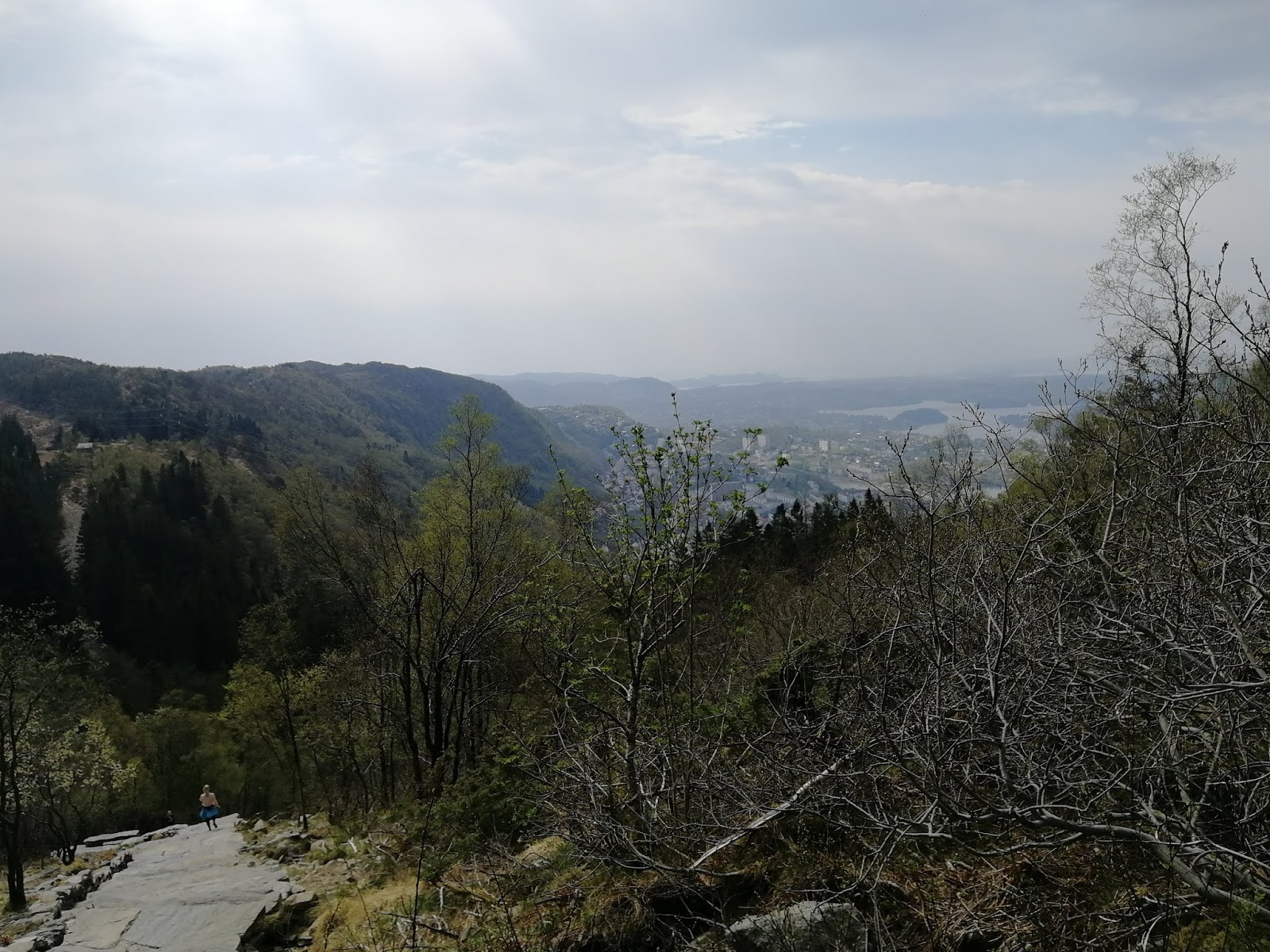
Even when the city wasn't in sight to look at, the immediate surroundings were also quite the view.
It was only on the way down that it really became apparent how steep those gravel roads were.
At certain bits, I felt like I was going to lose friction and slide.
After reaching the part where we would've returned to the forest trail, we instead headed down a street; that made the way down quite a bit longer in distance, but also much easier and safer.
The conditions down here were again quite summery, warm and pleasant, and it felt unreal that less than an hour earlier we had been right beside that tiny tower all the way up there, exposed to cold and howling winds.
The final timestamp-photo I took as we reached the base station again; the time was 14:43, which means that the descent took us one hour and 6 minutes.
After that feat was done, there was no doubt what was on the agenda next; we sat on the next bus back to the centre, went straight to our hotel room and rested for a while. We were exhausted and almost ready to call it a day. However, that didn't quite happen either; a few hours later we felt rested enough to head out again, but where we went and what we saw then, I'll write about in part 2.


No comments:
Post a Comment